
Storm to Bring Heavy Rain, Potential Mudslides, and Flooding to Burn Areas
Southern California residents are bracing for a powerful storm expected to bring significant rainfall between Wednesday and Friday. The storm poses a heightened risk of mudslides and debris flows in areas recently scorched by wildfires.
Flood Watches in Place for Burn Scar Areas
The National Weather Service has issued flood watches from 1 p.m. Thursday, Feb. 13, to 4 a.m. Friday, Feb. 14, for areas affected by recent fires, including the Eaton, Palisades, Franklin, and Bridge fire burn scars. These locations are at high risk for flash flooding and debris flows due to the lack of vegetation, which reduces the soil’s ability to absorb water.
Rainfall will begin Wednesday night with light showers, intensifying late Thursday into Friday.
Los Angeles County Prepares for Storm Impact
Rainfall estimates for Los Angeles County range from 1.5 to 3 inches, with mountain areas receiving up to 6 inches. At peak intensity, rain may fall at rates of 0.5 to 1 inch per hour, which could lead to localized flooding.
Officials warn of possible road closures and flood advisories across the county. Meteorologist Ryan Kittell advises residents to stay home and heed evacuation warnings if issued.
Emergency crews have been working to mitigate risks:
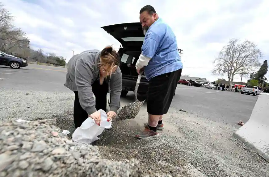
- L.A. City and County Fire Departments have installed K-rail barriers and sandbags in flood-prone areas.
- L.A. County Fire Department has cleared 500 debris basins and laid three miles of channel drains near the Eaton and Palisades burn scars.
- Free sandbags are available at all L.A. city and county fire stations.
Governor Gavin Newsom visited the Eaton Fire burn scar in Altadena on Tuesday to oversee preparation efforts. The state has deployed:
- 319,000 sandbags and 5,600 super sacks
- Hundreds of additional fire engines
- 400 emergency response personnel across multiple counties
Orange County and Inland Empire Prepare for Flooding Risks
Forecasts predict 1 to 1.5 inches of rain in lower elevations and 3 to 4 inches in the Santa Ana Mountains.
- San Bernardino County: Areas downslope from the Line Fire burn scar (Highland and Yucaipa) could see intense rainfall of 0.5 inches or more per hour, increasing the risk of mudslides.
- Orange County: Officials are closely monitoring the Airport Fire burn scar in Trabuco Canyon, though the risk of major debris flows currently appears low.
Fire departments in San Bernardino and Orange counties have been working to clear debris and reinforce storm infrastructure. Search and rescue teams are on standby, and officials urge residents to monitor weather alerts and prepare for potential evacuations.
Residents Urged to Take Precautions
Authorities recommend residents, especially those near burn scars, take preventive measures:
- Clear gutters and drains to prevent flooding.
- Place sandbags around homes to divert water and debris.
- Follow emergency alerts and evacuation orders immediately if issued.
“Your ability to get out might be nonexistent,” warned Eric Sherwin of the San Bernardino County Fire Department, “and our ability to get to you is equally as difficult.”
Recent Wildfires Increasing Risk of Flooding
The following wildfires have left large burn scars, making these areas vulnerable to flash flooding and mudslides:
- Hughes Fire (Jan. 22, Castaic Lake) – 10,425 acres
- Palisades Fire (Jan. 7, Pacific Palisades) – 23,707 acres
- Eaton Fire (Jan. 7, Altadena/Pasadena) – 14,021 acres
- Franklin Fire (Dec. 9, Malibu) – 4,037 acres
- Airport Fire (Sept. 9, Santa Ana Mountains) – 23,526 acres
- Bridge Fire (Sept. 8, Angeles National Forest) – 56,030 acres
- Line Fire (Sept. 5, near Highland) – 43,978 acres
Stay Updated
Residents should monitor weather alerts, prepare for potential evacuations, and take proactive safety measures ahead of the storm.